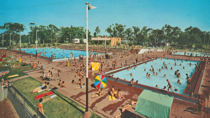
(ABOVE): Husband Rd swimming pool, Forest Hill (from 1959 postcard).
The suburb of Forest Hill is situated on Wurundjeri land, a clan of the Kulin tribe and is 18Km from Melbourne’s central business district. At the 2016 Census the population was 10,626.
In the north it is bounded by Canterbury Road (previously Delaneys Road), to the south by Burwood Highway (Boundary Road), and it straddles Springvale Road (once known as Hunt’s Road) for several kilometers until it reaches Blackburn in the west and Vermont in the east.
There are a two unproven versions of when and how Forest Hill received its present and official title. One is that Forest Hill is said to derive from the name of a cottage owned by an early settler, Captain Bunbury, and is descriptive of the district’s original bushland.
However, an oral history by Mary Cooke (ne Johnston) who spent her childhood in the area knew it as Forest Hill, never Tunstall. (She was the grand-daughter of Ernest Clifton, who became postmaster and general storekeeper in 1917.)
In 1868 Archibald McArthur bought six acres of sloping ground, which became a productive flower farm, situated on the north side of Canterbury Road near the north western corner of Springvale Road. The general area had been known as Scotchman’s Hill and later Mt Pleasant.
At Mt Pleasant, the Wesleyans requested State aid for their school, formed a committee and hired John Winter to commence teaching in June 1865. The committee then applied for a new school, which, as a result was built at a new site at the junction of McGhee’s (Mitcham) Road and Delaney’s Road (Burwood Highway). The new school opened in 1870.

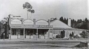
On land owned by Archibald McArthur the first post office opened on 1 March 1874 in the general store and home which was run by a family member, Catherine PEACOCK. The slab-roofed building on Canterbury Road had a hitching post for the visiting horses, and early settlers recalled that both Mrs Peacock and her daughter would deliver groceries and mail by horse and cart. The McArthurs continued to live in the original post office residence on Canterbury Road before demolishing it in c1950 to make way for their new home.
When the suburb became officially known as Forest Hill is unclear; but it was known by that name during the height of the local Land Boom of subdivisions in 1961–62.
The shopping centre, Forest Hill Chase

Where the present-day shopping Centre of Forest Hill Chase is situated is where Robert Kefford and William Dickenson had been allotted the Crown Grants 94 and 95. In due course these were broken up into smaller units for mainly fruit and poultry farms. It wasn’t until the 1950s that an outdoor strip shopping centre was built between Mahoney’s Road and Pacific Way.
Forest Hill’s conversion from a hybrid (strip mall/indoor) centre to a fully indoor site began in June 1987 with the demolition of the strip mall section, and the construction of a three-storey extension to the existing building, which housed major tenants including Coles, Kmart and Hoyts, and was completed in 1989.
(Left): Forest Hills Shopping Centre c1968
