
Beginnings
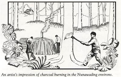
Before the first freehold land sale in this area took place in 1850, it was mostly involved with charcoal and timber products. It was then illegal to fell timber within five miles of Melbourne. The roads were bad, and it was found/thought easier to transport charcoal than timber; it is thought that a number of charcoal burners operated in the area.
Early maps and surveys
In 1841, two Special Survey maps described a reserve of 5120 acres, bounded on the north by Koonung Koonung Creek, (a tributary of the Yarra Yarra River). The acreage consisted of open forest, ferns, sandy soil, Oak Gums, honeysuckles, and Wattles. On the southern border was a hut belonging to James Stanley and his block, half of which was given over to growing wheat. On the south side of the Koonung Koonung Creek was Mr Arundel Wrighte’s cattle station, (making him possibly the earliest permanent settler in the area). At the south-east corner of the acreage the boundary was marked by the Kooyou Koot Creek (later Kooyong Koot Creek) and Mr Mullin’s station.
By 1855, the County of Bourke included the Parish of Nunawading. The land was described as moderately undulating clay and sandstone of poor quality. The vegetation included abundant coarse, wiry grass and scrub. A permanent water supply was obtainable from the Dandenong Creek, while waterholes in the Koonung Koonung Creek persisted in ‘ordinary summers’. The Parish was bounded (north) by the Koonung Koonung Creek, the Dandenong Creek (east) and Ringwood, Highbury Road (south) and Boundary Road, (now Warrigal Road), west. In 1863, half of the Parish was known as Nunawading and was a reserve for firewood.
By 1878, the Shire of Nunawading (proclaimed in 1872) contained the areas now known as Box Hill, Blackburn, Forest Hill, Mitcham, Vermont, and part of Burwood (then the Village of Ballyshannassy) and Burwood East. Nestled between Blackburn and Mitcham was the area known as Tunstall.
In the 1854 census, when Nunawading was included as a parish for the first time, almost half of the 271 residents were children under the age of 15. In 1857 a public meeting formally requested the government to proclaim a road district; thus, the Nunawading Road Board was proclaimed on August 6, 1857.
Growth
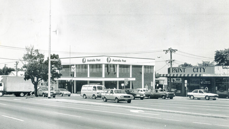
The first post office appeared in Box Hill in 1860, as did the first school. There was no water supply until 1894, and a wait of a further 30 years before the Shire of Nunawading received its electricity from the Victorian State Electricity Commission.
With the development of orcharding, floriculture and clay-based industries in the 1870s, the population increased. The 1881 census counted 1573 people in Nunawading Shire, which increased in 1882 when the railway line was extended from Camberwell to Lilydale. In 1888 Nunawading (then Tunstall) railway station was opened. The following year saw the opening nearby of Tunstall Post Office to service the small local community that had been/was described a “no-man’s land”, a “Cinderella” between the townships of Mitcham and Blackburn. There was a Methodist church, but the small local community was never really a township.
With local orchards growing and marketing flowers both for seed and for the Melbourne cut-flower market, spring was a picturesque season in the parish. Some growers specialized in particular flowers; others, like the Adult Deaf and Dumb Society, grew a broad range which might include carnations, dahlias, roses, gladioli and chrysanthemums. The soil was suitable for a wide variety of plants and flowers were transported by rail daily to the city.
Demand for bricks was high in the 1880s largely because of Melbourne’s growth, and the local clay industries developed rapidly to cater to the expanding interest in brick homes. The area possessed both high quality clays and good burning timber to feed the hungry kilns. The municipality was well positioned to take advantage of the booming construction industry – though equally well positioned to be effected by the results of its eventual downturn.
The Problem of a Name
From 1856 the name Nunawading had become nebulous in its use. As a locality name it had been replaced by Tunstall. A 1913 map produced by the Australian Intelligence Corps, 3rd M.D led by Lt. Col. John Monash, clearly shows Tunstall bounded by Whitehorse Road (north), Burwood Road (South), Blackburn Road (west) and Mitcham Road (east). Localities abutting Tunstall: Blackburn (west), Mitcham (east) and Tallyho (south). While still used as the Parish, and later Shire, name – it was also applied to various schools across the Parish. From 1856: Ballyshannassy Village, in 1861 on the border of Nunawading and Mulgrave and between 1858-1894, to three schools in Box Hill.
In 1925 the Shire of Nunawading vanished, replaced by the Blackburn and Mitcham Shire and Box Hill Borough, not resurfacing until 1945 when the Blackburn and Mitcham Shire became the City of Nunawading. It was then that Tunstall disappeared, and the suburb of Nunawading replaced it within the larger context of the city. The current boundaries accord with Monash’s 1913 map showing Tunstall’s boundaries.
Sources:
www.victorianplaces.com.au/nunawading
www.PROV.org.au Document series: VPRS 8168/P0002 SS2A & Sale 38 & Sydney B17; VPRS 8168/M/DEF 125; VPRS 8168/P0004 Plan 149.